ENB 150 Intro to Environmental Science
Monday, September 3, 2012
This is a video of the mile wide tornado hitting Tuscaloosa last year.
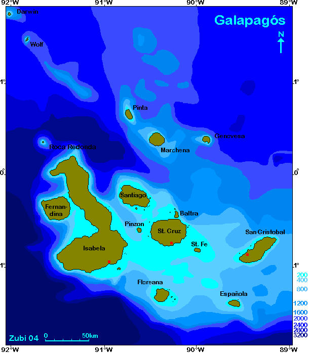
Bathymetric maps are the underwater equivalent of a topographic map.
A proportional symbol map uses different sized symbols to show data from a particular theme in a certain area.
Choropleth maps are used to show variability in a certain region or how a measurement varies in an area through color and pattern.
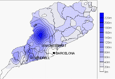
Isopleth maps are used to show elevation, which can help one figure things out such as rainfall patterns. Here is an example.
Dot density maps are used to give a visual of the density of something in a certain area. They are inexact, but give a general idea of the quantity.
Newer Posts
Home
Subscribe to:
Posts (Atom)